The Appalachian Flood of 1977
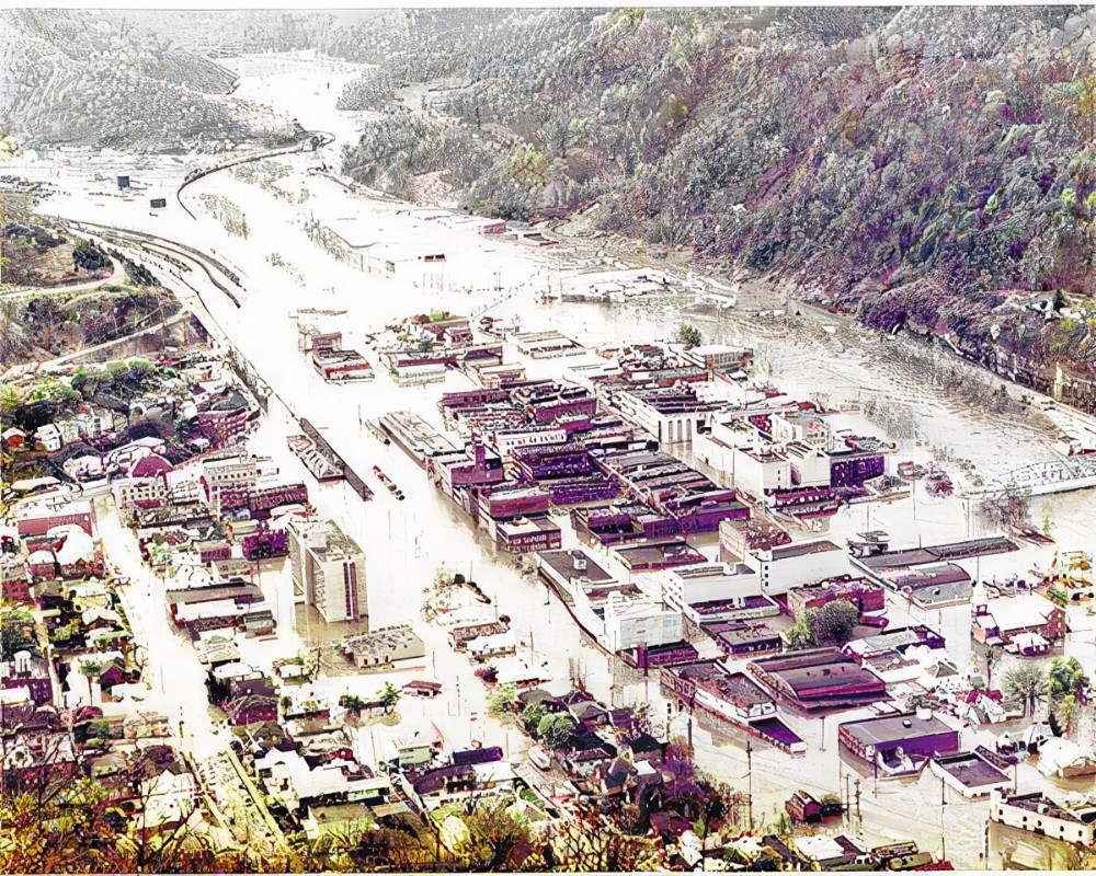
The Appalachian Mountains was once again pounded by torrential rains during April 2-5 of 1977. Kentucky, Tennessee, West Virginia, and Virginia was once again flooded. Record flood waters were recorded in the upper Cumberland River, Tug and Levisa Forks of the Big Sandy River, The Guyandotte River, Clinch and Powell Rivers, the North Fork of the Kentucky River and on the Holston River.
Fifteen Counties would be affected by the flood in Kentucky. They were Bell, Harlan, Pike, Johnson, Floyd, Letcher, Breathitt, Knott, Perry, Knox, Lawrence, Leslie, Magoffin, Martin, and Whitley Counties.
Flood Water
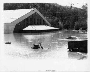
This actually happened in two stages. The first stage saw a rainfall of less than one inch over between April 2-3 of 1977. This saturated the ground and made it so that the rest of what was to come runoff water.
The second stage happened between evening of April 3rd through April 5th. The rainfall levels reached as much as 15.5 inches. This created conditions for a flash flood in the area.
Kentucky
At Pikeville, Kentucky the peak flooding would reach 51.46 feet and was 1.26 feet lower than the 1957 flood. The City of Pikeville would have damages estimated to reach seventy-one million dollars.
Peak stages in Prestonsburg were 45.71 feet. Flood waters reached a depth of 9 feet in the town of Martin. There was one death and 117 businesses that were destroyed or severely damaged throughout Floyd County. With nearly one thousand families suffering personal property losses.
Peak stages in Paintsville were 42.19 feet. Both Prestonsburg and Paintsville flood stages were 3 feet lower than the 1957 flood stage.

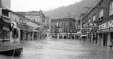
In the City of Harlan, six hundred dwellings were destroyed and two thousand families suffered personal loss. Five deaths were counted in the loss of life from the flood. The sewer treatment plant was flooded and businesses were severely damaged.
The City of Pineville was under fifteen feet of water after the water went over the tops of the levees and flood wall. In Bell County three people died, 674 injuries or illness were reported. One thousand five hundred and twelve families suffered personal losses to the flood. The City of Barbourville had been evacuated but the levees held and the town did not suffer any losses from water damage.
Tennessee
In Tennessee, rain had occurred on March 29-31, 1977. This storm saturated the soil with water that caused the next rainfall to become runoff water.
When the April 2-5, 1977 rains fell it caused record flooding in the Clinch and Powell River basins. The peak flood stge reached 38.96 feet which exceed the record set in 1826 by 9.4 feet.
The total damages were estimated at fifteen million dollars by the State Highway Department of Tennessee. This estimate was divided equally between roads, bridges, utilities, homes, and businesses.
Virginia
Record breaking flood water would be recorded by the Big Sandy, Clinch, Holston, and Powell River basins.
The peak stage of flood water on the Levisa Fork near Grundy, Va., reached 24.77 feet which was 5.71 feet higher than the previously recorded maximum in 1957. Levisa Fork at Big Rock, Va., crested at 27.38 feet, which was about 11 feet higher
than any peak recorded since records began in 1967. The Guest River at Coeburn, Va., crested at 20.95 feet which is five feet higher than recorded in 1957 and four feet higher than the flood of 1918.
West Virginia

Four to ten inches of rainfall was recorded over the Tug Fork River and upper Guyandotte River basins. Towns along the Tug Fork River were under 20 to 25 feet of water. Some of the small communities were completely under water.
In Williamson, WVa., the peak stage reached 52.56 feet and was the highest recorded since 1926 and about eight feet higher than the 1963 flood. The main business district of Williamson was protected by flood walls to an elevation of 44 feet.
Damages were estimated to be fifty million dollars in the Tug River Basin and in excess of ten million dollars in the Guyandotte River Basin. Damages in the Kanawaha River basin was estimated to be two million dollars.
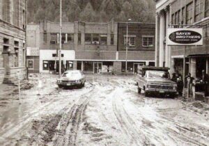
Damage to the Appalachian Towns’ Tally

The overall damages caused by the 1977 flood was devastating to the area. While many of the records of the flood water was not reached or broken from the 1957 Flooding, other records sadly were.
Twenty-two people in a four state wide area of which ten people killed by flood water in Kentucky. The damages would be estimated to reach one hundred and seventy-five million dollars in 1977 currency. Damages to small businesses reached excess of one hundred million dollars according to the Offices of the Small Business Administration. The fifteen counties that were affected in the state of Kentucky were declared a disaster area.
Hard Lessons Learned
Because of the lack of weather warning system that had an early detection system with it, many people did not have adequate time to evacuate with the 1957 or 1977 floods. The U.S. Weather Service began a system in October of 1980 to bridge that gap. With a total of 13 counties a 24-hour-a-day weather station was staffed with six meteorologist and an electronics technician. The system and station was tied into the Kentucky Early Warning System.
Pikeville, Kentucky also learned many lessons from the floods of the areas and began work on a three-phase project to move the Big Sandy River. This Project would become the Pikeville Cut-Through Project.
For more information about the Appalachian Flood of 1957 click here.
Thank You
Thank you for continuing to read and watch Kentucky Tennessee Living’s posts. We deeply appreciate it. Our goal has always been to bring the history back to the Appalachian Mountains.
Please Like, Subscribe, and Share Below. Also, hit the bell for notification of future videos. And once again be sure to leave us a “Hey Y’all” in the comment section below. Thank you for continuing to support us and watch our videos.
For More Information on the Appalachian Flood of 1977
Mountain Eagle
August 28, 1980
Horrific 1977 flood remembered
https://www.harlanenterprise.net/2019/04/05/horrific-1977-flood-remembered/
FLOOD OF APRIL 1977 IN THE APPALACHIAN REGION OF
KENTUCKY, TENNESSEE, VIRGINIA, AND WEST VIRGINIA
Report prepared jointly by the U.S. Geological Survey
and the National Oceanic and Atmospheric Administration
Report prepared jointly by the U.S. Geological Survey
U.S. DEPARTMENT OF THE INTERIOR U.S. DEPARTMENT OF COMMERCE
https://www.weather.gov/media
Weather Forecast Office
The East Kentucky Flood of April 1977
https://www.weather.gov/jkl/1977flood
Copyright and Other Information
All photos are in the public domain unless otherwise noted. This includes photos dated before 1923. All other photos are used with permission or under the education fair use statute of the US copyright law.
This work is licensed under a Creative Commons Attribution-Non-Commercial-No-Derivatives 4.0 International License.
Social Media
For more about us, you can visit our Facebook page:
https://www.facebook.com/kytnliving
Our Twitter page:
https://www.twitter.com/KYTNLiving
Our YouTube Channel:
https://www.youtube.com/kytnliving
When we forget our past and who we are as a people, then we become who “they” say we are. ~~ David Sergent


1 comment